Saturday 26 July 2014

KKK No. 9 - The Pilbara


“K K K”

 (‘Kimberley Karavan Kapers’ - Bruce and Audrey)

No: 9

The Pilbara

15 July, day 101 finds us departing attractive, touristy Broome and driving through the very extensive, treeless, grassy Roebuck Plains, just about the only decent grazing country for the following 400km or more of low, scrubby, treeless hard red terrain that marks the western extremity of Western Australia’s vast Great Sandy Desert.

Great Northern Highway

This particular portion of the State’s countryside may be ordinary, but WA’s Great Northern Highway is amongst Australia’s best. Km after km of consistently superb road.

Typical Pilbara Scenery
We passed by ‘the Eighty Mile Beach’ and topped up fuel at Sandfire Roadhouse at $1.96 per litre, traversing another 140km of arid, semi desert country until arriving at De Grey Rest Area, where we camped beside Pear Creek with a few others, in fine sunny weather

Salt Mine - Port Hedland
Another brisk morning followed as we drive the 90km to Port Hedland, a major iron ore port servicing the Pilbara mining region. We did our customary sightseeing of this mainly industrial town, in which Rio Tinto have a huge Salt Mining operation, and were back on the Great Northern Highway heading towards Newman, deep into the Pilbara
 
Loading Iron Ore
Driving south from Port Hedland, the first 200km was mostly flat to undulating grassy countryside running to distant hills, then the red rocky nature of the Pilbara starts to dominate, becoming increasingly red, rocky, hilly and harsh. After all, this is the heart of Australia’s rich, quality iron ore deposits, so beneficially recognised by local grazier Lang Hancock, flying his station aeroplane through these valleys in the early 1960’s. 

They just keep on coming!!!
The GN Highway services many mines throughout the region and the number of Road Trains using this road is truly remarkable. That day we passed, or were overtaken by scores of Road Trains, mostly 4 units’ long, outnumbering motor cars 3 to 1. Then a little nationalism was on display as we passed an isolated roadside hillock, in the middle of ‘nowhere’, with an Aussie Flag proudly fluttering in the breeze atop of it.

Go Aussie go!
That evening we discovered what is arguably one of our most scenic, free camp spots ever, the Albert Tognolini Mountain Reserve. Winding up the 2km track brings us to a high ridge overlooking picturesque rolling hills and green valleys, with many suitable camp spots offering panoramic views and a pretty sunset; though hard to leave such beauty next morning, plans to be at Karijini National Park that weekend called us on. 

Tognolini Mountain Reserve
Situated in the Hamersley Range in the heart of the Pilbara, the Karijini National Park enjoys a reputation for spectacular, rugged scenery and ancient geological formations; it is WA’s second largest national park, and we were not disappointed. We spent two days there and marvelled at the awesome scenery of Dales Gorge, including Fortescue Falls, Fern Pool, Circular Pool, and the Rim Walk overlooking it all. 

Dales Gorge - Karijini NP
Fortescue Falls
Lazy Gum on Rim Walk
Circular Pool
Next stop was the mining town, Tom Price, built by Rio Tinto in 1965 to service their open-cut iron ore mine at Mt Tom Price, following the discovery of iron ore there in 1962. The town was named for leading American geologist Thomas Moore Price whose initial involvement and enthusiasm bought it all to fruition.

Tom Price Open Cut Mine
We did a guided tour of the Rio Tinto owned mine, whose singular mining interest is iron ore only, with any other minerals being totally disregarded. Rio Tinto operates 15 other mines within the Pilbara, which are all serviced by Rio’s largest privately-owned and operated rail system in Australia, totalling 1600km of track. 

Quicker than a wheelbarrow!


The ore trains are 2.5km long and each hauls 27,376 tons of ore worth $3.5 million ($130 p/t), with five trains being the daily average from Tom Price mine alone. Little wonder their Shares are valued towards the top end of the ASX market!

That afternoon we left Tom Price via the Munjina/Nanutarra road, passing several mines but no trucks whatsoever on this lesser road, then turned south on Highway No1, passed across ‘Capricornia’ from the tropics into the temperate zone and camped at the Beasley River in company with newly made, fellow Kimberley Karavaners Peter and Ellie from Brisbane. Another blazing campfire, more stories, another bottle of red.

An eggs and bacon breakfast tell us it’s Sunday (20 July) and after a (big) 460km day towing the van at 80/90kph, Manberry Rest Area 90km north of Carnarvon is our address for the night, and to our great surprise very few trucks passed throughout the night.

The next morning we drove the 90km to Carnarvon, a modern, attractive town of 7000 pop., situated on the seemingly dry Gascoyne River, along whose rich river-bank soils are 16km of fruit and vegetable farms, irrigated by water pumped from the underground stream which flows several metres below the dry, sandy river bed. An amazing amount of water for so many irrigators! 

The Mile Long Jetty
 Other attractions include its ‘Mile Long Jetty’ constructed in 1897 and since restored, with its “Coffee Pot” train ferry service, and the old OTC Dish one used by NASA as part of their space communication and tracking station during the 60’s and 70’s space race, but since outdated and therefore decommissioned after tracking Halley’s Comet in 1987.

Rugged Sandstone Coastline
We topped fuel and food then drove 85km up the coast to Quobba Station, a working pastoral property with 80km of harsh, unpredictable and spectacular coastline bordering the Indian Ocean. Between sandy beaches, there are large areas of rugged sandstone foreshore and, with a strong on-shore breeze and powerful ocean swells, the Quobba Blowholes were booming geyser like jets of water up to 20 mtrs into the air. Spectacular!  

Quobba Blowholes
Quobba Station provides basic camping facilities behind beachfront dunes, offering land based game fishing, isolated beaches, king-wave surfing, crayfish snorkelling and whale watching, a few of which we’ve seen passing close by. 

Quobba Station Campsite
The Quobba lease was taken up in 1898, is approx 80km long by 14km wide, comprises 187,000 acres and runs around 10,000 Damaras, South African meat sheep, which grow hair rather than wool and therefore require no shearing. The country here is dry, sandy, low Saltbush scrub, more suited to pasturing the goat-like Damaras, occasioning the switch from Merinos some years ago. 

Hairy Damaras Sheep
We’ll leave here tomorrow after a 4 night stay, heading back to see more of Carnarvon before continuing our adventures further southwards.

Fully setup Campsite

 Bruce and Audrey
Quobba Station, Carnarvon
July 2014


Monday 14 July 2014

KKK No 8 Kununurra - Derby - Broome


“K K K”

 (‘Kimberley Karavan Kapers’ - Bruce and Audrey)

No: 8

Kununurra – Derby – Broome

It’s Wednesday 2 July, day 88, and we’re “back in the saddle again”, as they say, heading off down the challenging Gibb River Road on our second attempt to traverse the heart of the Kimberley, one of the Nation’s few remaining 4WD ‘frontier’ roads, apart from the sandy desert tracks.

The Gibb River Road was originally constructed as a beef road to transport cattle from surrounding stations to the ports of Derby and Wyndham, and travels some 700km through the central Kimberley Plateau, with its scenic beauty and grandeur, unusual landscapes, many gorges, waterfalls, Boab trees and red dust. The ‘Wet’ forces the Gibbs official closure for a few months and fines apply to travellers who breach the Restrictions.

The Gibb’s now had 18 more days of traffic and subsequent deterioration since our previous attempt and, like a thrown rider, I’m a little spooked about getting back on the horse, but determined to accomplish our goal. We soon discovered our apprehension was well grounded once we ‘hit the dirt’, with kilometre upon kilometre of dislodged sharp stones and corrugations noticeably worse in some places than previously.

Emma Gorge
  Not far along we reached El Questro Wilderness Park, home to Emma Gorge and did the 1.6km, hour long slog each way, quite a challenging walk, climb and rock crawl into this marvellous natural wonder, but ever so much worth the effort – simply stunning. Two waterfalls cascade 65mtrs (200 ft) down sheer red cliffs into a large deep pool, its cool clear waters hosting several hardy swimmers.

Other scenic rewards were there also as we once again enjoyed the grandeur of the Cockburn Range with its stunning plateau topped jump-up, plus the thrill of our third fording of the wide, stony bed of the Pentecost River.

Then a “brief taste of Heaven” occurred with an all too short 20km of newly graded road along which we raced at dizzying speed, up to 75kph, rather than our usual 50kph! Soon we arrived at our previously used, sheltered roadside gravel pit where we enjoyed another quiet night. The weather continues fine, with warm days and cool nights.


Day two finds us driving through km after km of recently burnt out, unremarkable red rocky country with savage corrugations in places, through the now dry Bindoola Creek bed, past the harsh, steep and rugged terrain of Gregories and Rollies Jumpups, thru Mosquito Hills with ridge after ridge interspersed with dry eroded floodways, and much hard sharp rock on the road. And all the while, clouds of billowing red dust - and more dust – everywhere.

Two abandoned 4WD’s and several tyre carcasses give testament to the harshness of this 4WD shortcut, a saving of over 300km from the Great Northern Highway through Halls Creek and Fitzroy Crossing, with a recommended top speed of 60kph.

Some of the better Grazing country
Onwards we continue past “Ellenbrae Station” turnoff, with no deviation for Devonshire Tea this time, and remark on how much more traffic is on the road than 18 days earlier. The excessive speed that some idiots drive at amazes us as we watch their suspensions hammering frighteningly over the corrugations, especially in hired 4WD’s.

Past Russ Creek with its Lilly covered waterhole and prolific stand of red Rosella plants and then we’re on the 1km strip of ‘black top’ than spans the Gibb Range, up and over the second ridge where we stop at the bottom to revisit our “old residential address” of four days, 2 weeks’ previously!

The eucalypt suckers and dead grass remains flattened – proof of recent habitation, but no tears are shed, and with a photo of the vacant lot for posterity, we’re back on the road once more with anticipation of new scenery around every bend.
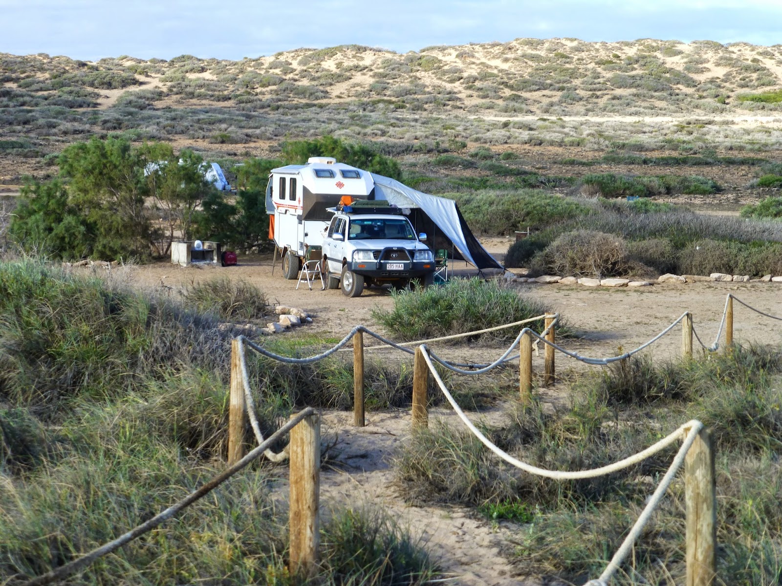
Eleven kilometres on we take the far more infamous Kalumburu Road northwards for a few km looking for a lakeside camping spot, but unable to find it by Plain Creek, we returned part way and freedom camped on the sandy bank at the Gibb River crossing, with several others.

Two cranky old Brahman Bulls passed through, loudly voicing their disapproval at our trespass, but our Bower Bird neighbour close by was far less offended by our presence; he continued to woo his ladybird, repeatedly bringing her through his bower to reveal the cache of all things shiny – small white pebbles, clear plastic, sparkling glass chips, blue plastic, silver foil, and 2 shinny coins, a 10c and a 5c. We can’t imagine how he got them, but we were so impressed we decided to invest in his love life and added another 10 and two shiny 5c pieces, and hope it adds to a successful outcome.

Bower Bird with his wealth
Off again in the morning on the 105km run through lovely open grasslands shaded with various eucalypts, bauhinias and associated timbers and interspersed with occasional water crossings. We forded Bryce and Mistake Creeks, followed by the Hann River and Snake Creek, and then took a very rough track for a very slow 3km into Bartlett River Gorge where we had smoko beside a downstream pool.
One of many Creek crossings
Back out on the GR Road, we followed the Barnett Range, an attractive red topped jump-up for several kilometres before fording the Barnett River and shortly thereafter arrived at the Mt Bartlett Roadhouse, approximately half way along ‘the Gibb’, where we filled up with Petrol at $2.50/ltr. It is owned and run by the local aboriginal community.   

The Manning Gorge campground nestles beside the Manning River 7km out back from the Roadhouse and we set up there for the night. The river at the camp has a lovely clear sandy and rock bottomed pool, which must be crossed to view the lovely Manning Gorge. Not so long ago one had to swim the 60mtr waterhole to start the 2km trek but a small aluminium punt allows a crossing by a pull-it-yourself rope and pulley system.

DIY Crossing
Typical "easy" gorge walk!
  We crossed the next morning, the first starters at 7am, for the 3 hour, strenuous ‘class 4’ return walk to Manning Gorge. The walk, like most of the Gorge walks in the Kimberley, requires more effort than the glossy tourist brochures elude, many with little scenic interest along the way, but the reward comes at the end and Manning is certainly worth the effort. The Gorge walls, waterfall, pristine rock pool, aboriginal art, the vibrant colours and rock formations all make for a rewarding experience. 

Manning Gorge
It was only mid morning following our return from the Gorge and having seen all of interest we decided to be off. This next section was, in places, as roughly corrugated and stony as any before, through only fair grazing country with very low quality, inbred Brahman cross breeders, as was often the case in Aboriginal Land Council controlled cattle stations.

Soon after we reached the Imintji aboriginal community whose BIG little store on the Gibb sells groceries and Diesel fuel, but no petrol; we stopped for an Ice Cream before continuing on to the Mt Bell Lookout, with its panoramic outlook over nothing particularly exciting, and a little farther on is our next overnight stop, where we freedom camped beside the creek at green and shady March Fly Glen. (No March Flies or any insects).

It had been many days since our last campfire so ‘pyromaniacal Bruce’ went scavenging firewood and, in company with our new caravanning ‘neighbours’, Peter and Jane from Perth, shared a bonzer fire and good conversation over a bottle of Red.  

The Firewood Scavenger
Early next morning finds us out on the road heading past Galvan’s Gorge – today we’ve got a bigger gorge in mind, fording the Adcock River, on past Stumpy’s Jumpup and through Napier Downs Station (Audrey never told me about that!) and soon after crossing the Lennard River we take the Leopold Downs Road 21km in to Windjana Gorge National Park.

The floodwaters of the Lennard River have carved a 3.5km long Gorge through the limestone of the Napier Range, and for most of the year only pools of water are found in the Gorge for the river only flows during the wet.

Geologists regard the Gorge as one of the classic features of world geology, for nowhere else are various deposits of an ancient reef complex so well exposed as they are at Windjana. Fossils of shells and the creatures that lived in Devonian times can be seen preserved in the 100 metre high limestone walls. Fresh water Crocodiles are plentiful as is their diet of archer fish, cherabin and bream.

We set up camp at Windjana together with over 150 other tourists and, after lunch, leave the Karavan and drive a further 37km of rotten road on to Tunnel Creek National Park, a major highlight of the trip so far.

Tunnel Creek Entrance
Over millennia Tunnel Creek has carved its way underground through the limestone, resulting in a 750 metre long cavernous tunnel and during the dry season it is possible to walk through the creek, which is cold and over knee deep. Armed with flashlights and camera, we did the walk and marvelled at the ‘artistic complexity’ of the high eroded ceilings and the giant stalactites that graced them. A further boon was two pieces of aboriginal art on the rock face at the far entrance to the tunnel.  

Aboriginal Wall Art
Next morning we did the 7km return walk through Windjana Gorge, with its 180 million year old imposing sandstone cliffs overlooking long waterholes in which freshwater Crocodiles were sunning themselves. A most interesting and enjoyable three hour walk.

Windjana Gorge
A couple of the locals!
We departed Windjana early next morning, but 5 minutes too late to avoid being caught up in the group of 55 Motorcyclists riding Postman’s small 110cc Hondas on an annual Police fundraiser up the Gibb. Crazy – two riders were ‘thrown’ in the first rough 20km back out to the Gibb Road junction, in addition to the WA Police Commissioner who was unseated the previous day.

Motor Cyclists on Police Fundraiser
Anyway, we turned left for Derby and soon we were on the ‘black top’ with the horrors of the Gibb River corrugations, stones, river crossings, washouts and general ruggedness now behind us.

Derby is a pretty little place on King Sound, with wide shaded streets, but no definable CBD, has a sizable aboriginal presence and many Boab trees. We booked in, then went exploring the town, taking in a large art exhibition, the old gaol, hollow Boab Prison Tree, and waterfront at the port jetty.

Old "Open' Derby Gaol
Hollow Boab Prison Tree
Derby has the greatest tidal range of anywhere in Australia, up to 11.8 metres at HW Springs. Nova Scotia's Bay of Fundy in Canada has the world’s highest tidal range 15m.

Derby plays host to Western Australia’s largest Indigenous cultural event, the annual Mowanjum Festival which highlights West Kimberley aboriginal culture, encompassing their art, with fully costumed corroborees, song and dance, all open to the general public.
The famous Wandjana art featured in Sydney’s 2000 Olympic Games opening ceremony. 

Wandjana Spirit - Mowanjum Art
Word had reached us that the Jetty Restaurant at the Port was the best in town - fine seafood dining watching the Sunset over the water, which we thoroughly enjoyed the next night prior to departure the following morning.

Sunset at Jetty Restaurant, Derby
About 100km south we stopped at the Nillibubbica Rest Area, joining 35/40 others for the night, and by 7:15 next morning we’re on the 105km leg into Broome, with its grossly inflated ‘seasonal’ campsite fees up to $60/day, but we’d heard the Pistol Club had powered sites for $35 so we stopped there.

Broome was founded as a pearling port in the 1870’s and remains steeped in the history of Pearls. Named for WA Governor Broome in 1883, it is a colourful, welcoming touristy town based now on its cultured Pearl industry, since the 1950’s, and cattle grazing. 

Roebuck Bay Foreshore
The town  has a fresh, modern appearance, and the bright turquoise waters of Roebuck Bay contrast appealingly with the red rocky foreshores of this unique peninsular.

Dampier Terrace, the Street of Pearls in ‘old’ Broome’s Chinatown is as vibrant as Surfers Paradise, and Saturday’s Arts and Crafts Market a plethora of stalls. A Chinese lady makes lovely high quality Doonas, filled with cocoons of imported natural pure Silk, and one of these now covers our bed.

Cable Beach at Sunset
A must do in Broome is to join the throngs of people who watch tourist Camel Rides along Cable Beach at Sunset, while enjoying nibbles and champagne from the grassy hilltop, and we did just that. Another is to see the ‘Stairway to the Moon’, a natural phenomenon which occurs at low tide when the Full Moon rises above the Horizon to reflect a stairway reflection across tidal flats back to the viewer, which we’ll do this evening.

Tomorrow we will depart Broome, destination ‘the 80 mile beach’ on our 100th. day away.

We’ll talk again soon
Bruce and Audrey
14 July 2014

Tuesday 1 July 2014

KKK No 7 Kununurra and the Gibb River Road

  “K K K”

 (‘Kimberley Karavan Kapers’ - Bruce and Audrey)

No: 7 Kununurra and the Gibb River Road

Salvage and Sorrow

It’s Saturday 14 June, day 70: we’re bathed in balmy Kimberley sunshine at 7:45am as we top up petrol at $1.90/ltr and excitedly depart Kununurra to commence our Kimberley adventure, bound for Wyndham, whose establishment in 1885 opened up this vast region, with its main Port situated on the broad, swiftly flowing upper reaches of Cambridge Gulf where tidal range exceeds 8½ metres. Normal tidal ranges worldwide range 2 to 3 metres.

Wyndham’s a small disjointed town with the old section at the Port, some 5 km distant from the ‘new’ town. Michael Durack (of ‘Kings in Grass Castles’ fame) arrived here in 1882 and commenced his family’s extensive cattle empire, the precursor to establishment in 1919 of the huge Wyndham (Government) Meatworks, the then lifeblood of the entire Kimberley region. 

The Big Croc
Home to perhaps the worlds biggest ‘Crocodile’, the 20metre sculpture in the main street was made by local TAFE students in 1988, contains 55 kilometres of steel rod, 10 rolls of chicken wire and six cubic metres of concrete. In addition to its abundance of real saltwater Crocodiles, Wyndham is also famous for its Prawns, so we bought a kilo of green ones for $20 from a trawler at the Port wharf.

"Our" Prawn Trawler at Wharf
Then we hauled the ‘Karavan’ up the 4km long, continually rising steep road up to the “Five Rivers Lookout” in the Bastion Range, 330 mtrs above Wyndham, to view where the King, Ord, Durack, Forrest and Pentecost Rivers join together and flow into the gulf.


View from Five Rivers Lookout
Wyndham Township was proclaimed in 1886 and the local Cemetery, predating the 1890’s, reflects the arrival of Afghan Cameleers into the Kimberley, and from there throughout central Australia. Many of the Afghan graves are very large, due to the custom of the lead camel often being buried with its Master.

By early afternoon we’re retracing our path back to the turnoff of the Gibb River Road, stopping enroute to check out ‘The Grotto’, a steep descent of 140 steps to a cavernous ravine of water 300 feet deep. 

The Grotto from above
Upon reaching the Gibb River Road we stopped to deflate all the tyres for better gravel road performance. A little further along we forded the 100mtr, over-knee-deep Pentecost River, the first of several watercourses along this 600+ km of challenging dirt road and then shortly after, we enjoyed the broad vista of the Cockburn Range from the roadside lookout.

Great Scenery along the Gibb River Road
Much Rougher than it Looks!


Cockburn Range

The Pentecost River Crossing
Fording the Pentecost
The road was rough and dusty, with many stretches of bad corrugations, and occasional other travellers creating dust clouds, so we were very pleased to call it a day by 4pm. We found a sheltered roadside spot 20km past the Pentecost, after a Dingo ‘played chicken’ scampering across the road, the only wildlife (except birds) we’ve seen in weeks. We enjoyed a top cuisine dinner tonight of (Wyndham) sauté Garlic Prawns. Yum Yum!!

 
1kg of Yum Yum!!!
Next morning, Sunday 15 June, day 71, finds us passing through reasonably open forest grazing on a not too bad, corrugated, stony road (but still limited by road conditions to 50/70 kph) which brings us to our second riparian thrill, fording the Durack River, then brief respites of bitumen as we pass over Gregories, then Rollies Jump-Ups, and ford a deep, rocky, short creek on the 5km sidetrack into “Ellenbrae Station” Campground, lured there by the seductive roadside signage of Devonshire Teas.

Many hidden rocks in 'Ellenbrae' creek
Devonshire Tea with 'Ellenbrae' wild Finches
The stony road-table improved after “Ellenbrae” to a much kinder surface and soon we were on another bitumen strip that overran the low twin ridges that constitute the Gibb Range where, upon cresting the latter, we experienced a most explosive tyre blowout on the Karavan, white smoke billowing everywhere in the external view mirror.

It’s 1pm, we’ve stopped right on the hill crest and soon two roadworks men come by and help to change the spare wheel and we’re soon back on the move – but not for long!! About 17 seconds and 150 metres later white smoke is again pouring off the same right van wheel and we hastily come to a stop in the table-drain, at the bottom of the hill, fortuitously about 200 mtrs before the end of the clean, dust free bitumen, which ‘address’ was to become our ‘home’ for the next 4 days and 3 nights! 

Home 'Address' for four days
 We are 10km east of the Kalumburu turnoff, 340km from Kununurra, 420km east of Derby with nearest civilization 110km west at the Mt Bartlett Roadhouse. Thank goodness Audrey had the presence of mind to buy a Satellite Phone so we phoned RACQ in Brisbane, 3331km away as the crow flies, and rescue plans commenced immediately.

They phoned back shortly to advise a Derby truck was in the area and would come later that day, but it didn’t arrive ‘til 10am the following morning, and after a couple of hours it was apparent to me the semi-trailer was unsuitable for the job and that our Karavan would be surely damaged by his improvised sling arrangement, so I declined his services and asked RACQ to arrange an appropriate Tilt Tray Truck recovery, which they said would take another day.

The first recovery attempt, unsuccessful
Perhaps ten to fifteen vehicles passed each day and though we waved down no one, only a very few stopped to enquire of our plight. Of course, we had plenty of food and water and books and our I-Pads, but there was nothing they could do to help. So there we stayed, 1½ metres from the bitumen for our second night, though thankfully, no traffic at all uses the Gibb River Road after dark. 

Waiting, waiting, waiting!
Tuesday 17, day 3 shines hot and sunny and after several more Sat Phone calls each way we’re told we’ll be collected the following morning by a ‘Motor Workz’ Tow Truck from Kununurra. So we spend our third day waiting – waiting, and again sleeping beside the road. During the day I jack up and remove the van wheel and discover the problem – the swing arm independent suspension is totally cracked/broken on 3 sides, allowing the wheel to roll inwards at the top, slicing the tyre completely around its inner wall.

Broken Suspension and rubbing tyre
Then, next morning, as if we haven’t suffered enough stress and concern, our hearts sink as we watch a Motor Workz rescue truck go racing past us outbound before we knew it and assumed he must not be ‘ours’. With no other Motor Workz truck in sight, a few hours later as he came back, we waved him down and he discovered that we were in fact ‘his job’ so, into the table drain he unceremoniously dumped the camper he had wrongly picked up and hauled us aboard. If we hadn’t stopped him we’d have spent another tedious day and night beside the road!

Unceremoniously dumped Camper Trailer
Recovery at last
Damaged swing arm suspension
The sad news arrived about an hour earlier, by Satellite Phone that my twin brother John had passed away the previous afternoon, ending his battle with Alzheimer’s. Once again our Sat Phone proved its worth.

We arrived back in Kununurra mid afternoon and took up residence in a Villa unit in the Town Caravan Park, and over the next two days, the sizable Argyle Engineering Company welded up the suspension; a further two days later on 22 June I was able catch a flight to Brisbane via Perth, returning to our Cannon Hill house.

A few very busy days followed as brother Grahame and I made arrangements for John’s cremation and Memorial Service, a most comforting and memorable event that took place on Friday 27 June, attended by so many of his friends and relatives.

Vale John Newton Vidgen - 1944-2014
Remembering the good times
Sunday 29 June saw me fly back to Kununurra via Broome direct, and we plan to depart Kununurra again in a couple of days to recommence our adventure down the challenging Gibb River Road. Let us hope we can give you a better story in our next KKK Report.

Love and best wishes
Bruce and Audrey.

Kununurra
30 June 2014