“K K K”
(‘Kimberley
Karavan Kapers’ - Bruce and Audrey)
No: 9
The Pilbara
15 July, day 101 finds us departing attractive, touristy
Broome and driving through the very extensive, treeless, grassy Roebuck Plains,
just about the only decent grazing country for the following 400km or more of
low, scrubby, treeless hard red terrain that marks the western extremity of
Western Australia’s vast Great Sandy Desert.
 | ||
| Great Northern Highway |
This particular portion of the State’s countryside may be
ordinary, but WA’s Great Northern
Highway is amongst Australia’s best. Km after km of
consistently superb road.
 |
| Typical Pilbara Scenery |
We passed by ‘the Eighty Mile Beach’ and topped up fuel at
Sandfire Roadhouse at $1.96 per litre, traversing another 140km of arid, semi
desert country until arriving at De Grey Rest Area, where we camped beside Pear
Creek with a few others, in fine sunny weather
 |
| Salt Mine - Port Hedland |
 |
| Loading Iron Ore |
Driving south from Port Hedland, the first 200km was mostly
flat to undulating grassy countryside running to distant hills, then the red
rocky nature of the Pilbara starts to dominate, becoming increasingly red,
rocky, hilly and harsh. After all, this is the heart of Australia’s
rich, quality iron ore deposits, so beneficially recognised by local grazier
Lang Hancock, flying his station aeroplane through these valleys in the early
1960’s.
 |
| They just keep on coming!!! |
 |
| Go Aussie go! |
That evening we discovered what is arguably one of our most
scenic, free camp spots ever, the Albert Tognolini Mountain Reserve. Winding up
the 2km track brings us to a high ridge overlooking picturesque rolling hills
and green valleys, with many suitable camp spots offering panoramic views and a
pretty sunset; though hard to leave such beauty next morning, plans to be at
Karijini National Park that weekend called us on.
 |
| Tognolini Mountain Reserve |
Situated in the Hamersley
Range in the heart of the Pilbara, the
Karijini National Park enjoys a reputation for
spectacular, rugged scenery and ancient geological formations; it is WA’s
second largest national park, and we were not disappointed. We spent two days there
and marvelled at the awesome scenery of Dales Gorge, including Fortescue Falls, Fern Pool, Circular Pool, and the
Rim Walk overlooking it all.
 |
| Dales Gorge - Karijini NP |
 |
| Fortescue Falls |
 |
| Lazy Gum on Rim Walk |
 |
| Circular Pool |
Next stop was the mining town, Tom Price, built by Rio Tinto
in 1965 to service their open-cut iron ore mine at Mt Tom Price, following the discovery
of iron ore there in 1962. The town was named for leading American geologist
Thomas Moore Price whose initial involvement and enthusiasm bought it all to
fruition.
 |
| Tom Price Open Cut Mine |
We did a guided tour of the Rio Tinto owned mine, whose
singular mining interest is iron ore only, with any other minerals being totally
disregarded. Rio Tinto operates 15 other mines within the Pilbara, which are
all serviced by Rio’s largest privately-owned and operated rail system in Australia,
totalling 1600km of track.
 |
| Quicker than a wheelbarrow! |
The ore trains are 2.5km long and each hauls 27,376 tons of
ore worth $3.5 million ($130 p/t), with five trains being the daily average from
Tom Price mine alone. Little wonder their Shares are valued towards the top end
of the ASX market!
That afternoon we left Tom Price via the Munjina/Nanutarra
road, passing several mines but no trucks whatsoever on this lesser road, then
turned south on Highway No1, passed across ‘Capricornia’ from the tropics into
the temperate zone and camped at the Beasley River in company with newly made,
fellow Kimberley Karavaners Peter and Ellie from Brisbane. Another blazing
campfire, more stories, another bottle of red.
An eggs and bacon breakfast tell us it’s Sunday (20 July)
and after a (big) 460km day towing the van at 80/90kph, Manberry Rest Area 90km
north of Carnarvon is our address for the night, and to our great surprise very
few trucks passed throughout the night.
The next morning we drove the 90km to Carnarvon, a modern,
attractive town of 7000 pop., situated on the seemingly dry Gascoyne River,
along whose rich river-bank soils are 16km of fruit and vegetable farms,
irrigated by water pumped from the underground stream which flows several
metres below the dry, sandy river bed. An amazing amount of water for so many
irrigators!
 |
| The Mile Long Jetty |
Other attractions include its ‘Mile Long Jetty’ constructed
in 1897 and since restored, with its “Coffee Pot” train ferry service, and the
old OTC Dish one used by NASA as part of their space communication and tracking
station during the 60’s and 70’s space race, but since outdated and therefore decommissioned
after tracking Halley’s Comet in 1987.
 |
| Rugged Sandstone Coastline |
We topped fuel and food then drove 85km up the coast to
Quobba Station, a working pastoral property with 80km of harsh, unpredictable
and spectacular coastline bordering the Indian Ocean.
Between sandy beaches, there are large areas of rugged sandstone foreshore and,
with a strong on-shore breeze and powerful ocean swells, the Quobba Blowholes
were booming geyser like jets of water up to 20 mtrs into the air.
Spectacular!
 |
| Quobba Blowholes |
Quobba Station provides basic camping facilities behind
beachfront dunes, offering land based game fishing, isolated beaches, king-wave
surfing, crayfish snorkelling and whale watching, a few of which we’ve seen
passing close by.
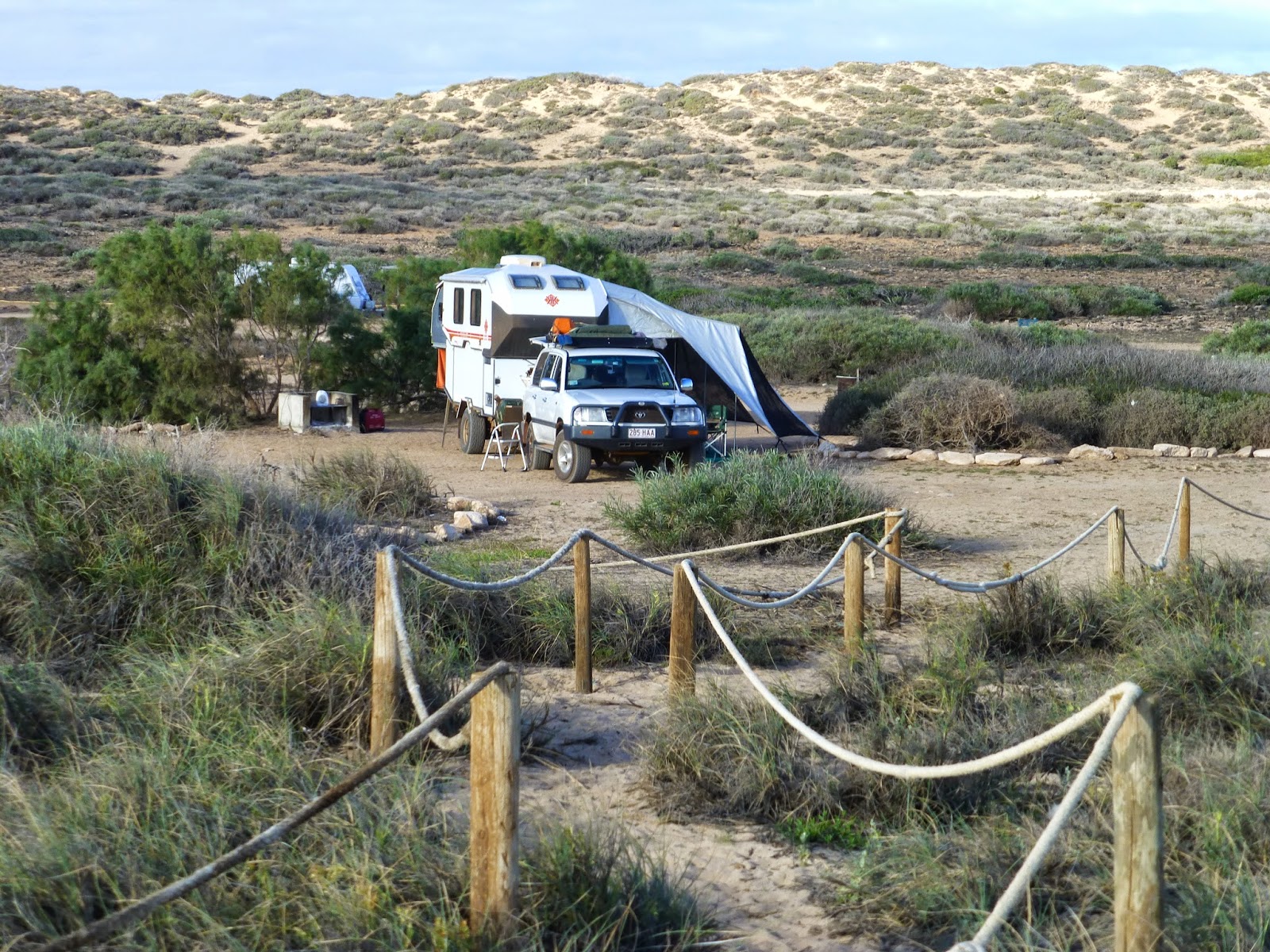 |
| Quobba Station Campsite |
The Quobba lease was taken up in 1898, is approx 80km long
by 14km wide, comprises 187,000 acres and runs around 10,000 Damaras, South
African meat sheep, which grow hair rather than wool and therefore require no shearing.
The country here is dry, sandy, low Saltbush scrub, more suited to pasturing
the goat-like Damaras, occasioning the switch from Merinos some years ago.
 |
| Hairy Damaras Sheep |
We’ll leave here tomorrow after a 4 night stay, heading back
to see more of Carnarvon before continuing our adventures further southwards.
 | ||
| Fully setup Campsite |
Quobba Station, Carnarvon
July 2014


No comments:
Post a Comment